Home Severe Weather Network Spotter Information Severe Weather History Weather Photos Weather Links

Severe Weather Photos


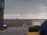
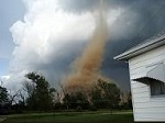
Tornadoes and Funnel Clouds

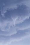
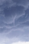
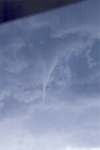
Cheyenne, Wyoming June 24, 2014 - Funnel Cloud West of Cheyenne - Photos by Blaine McCartney and Jon Green.
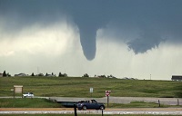
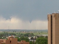
Casper, Wyoming May 23, 2014 - Tornado on Casper Mountain
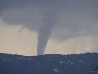

Cheyenne, Wyoming July 29, 2013 - Northwest of Cheyenne - Photo by Laurie Day
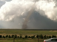

Near Burns, Wyoming May 18, 2010


Cheyenne, Wyoming May 18, 2010 Tornado South of Cheyenne


Cheyenne, Wyoming May 22, 2008 Near I-25 and College Ave - Taken by Summer Wasson


Cheyenne County Nebraska Tornado - May 27, 2007 - Taken by Kristine Bond
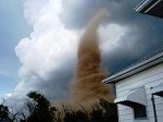

Scottsbluff Tornado, March 30, 2005


Centennial Tornado, May 24th, 2003. Photos by Diane Masonbrink
These pictures were taken just east of Centennial, WY (about 30 miles west of Laramie, WY) looking south towards the Lake Owen area on Saturday May 24th around 2 p.m. Some trees were reportedly uprooted near the Boswell Ranch near the Colorado/Wyoming border.


Cheyenne, Wyoming June 18th, 1997. Taken from northeast Cheyenne.
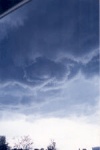


Cheyenne, Wyoming June 14, 1987. Taken north of Cheyenne from Ridley Road looking to the northeast. Prior to Doppler Radar this small tornado was unknown to National Weather Service personnel.
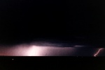
Photo by Paul Sellner.

Laramie, Wyoming This short lived tornado occurred in Laramie at an elevation of 7100 feet, and situated between the Snowy Range and Laramie Range mountains.
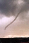
Photographer unknown.

Cheyenne, Wyoming. Although this thunderstorm did not produce any severe weather, it did provide some tense moments as wall cloud passed over residential areas in northwest Cheyenne. Taken July 22nd, 1983.
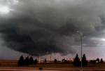
Photo by Paul Sellner

Cheyenne, Wyoming July 30, 1979, looking west. The tornado is at a distance of 10 to 12 miles. The first photo, the tornado may be difficult to see, it is located just to the left of center. The second photo, the tornado is much larger, as shown by the change in size of the debris cloud on the ground, although no funnel from the cloud is visible. Photographer unknown.
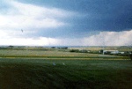

The Cheyenne Tornado - July 16, 1979.

Thunderstorms

Large thunderstorms may not always visit the Cheyenne area, but with wide open spaces and little to block the view there are often some very impressive scenes throughout the spring and summer months. It is not unusual to see large towering thunderstorms visible that are 50 miles or more away. This series of photos shows thunderstorms at great distances viewed from Cheyenne, including near Chugwater, Wyoming, Pierce, Colorado and Torrington, Wyoming.

Photo by Paul Sellner

Lightning

Vivid lightning often accompanies many thunderstorms during the summer months in southeast Wyoming.

This series of photos was taken northwest of Laramie, Wyoming.

Photos by Paul Sellner

Cheyenne, Wyoming.
Photos by Paul Sellner

Floods

Flooding in the Cheyenne area occurs almost every summer, however, most of the time it is limited to urban street flooding.

On August 1, 1985, a large thunderstorm (~65,000ft) parked over Cheyenne and delivered 6.06 inches of rain over a very wide area in a few hours. This series of photos was take from the Western Hills subdivision, much of which is located near the headwaters of Dry Creek.
Photos by Paul Sellner

Hail Storms

Southeast Wyoming is located in "Hail Alley" and frequently sees hail fall from almost every thunderstorm during the summer. Periodically, the hail stones are large and cause millions of dollars of damage. This series of photos are from the second most costly hail storm in Cheyenne, Wyoming 1987. Photos by Paul Sellner

Wind Storms

Wind, wind, wind. Everyone knows the wind blows in Wyoming, especially in the Spring and Fall. Sometimes wind gusts can reach 50 to 70 miles per hour. On occasion wind gusts have been clocked at 100 miles per hour in and around the Cheyenne area.

The Wyoming Wind Sock, located outside the National Weather Service Office Cheyenne, Wyoming.

You certainly cannot see the wind, but you can see its effects. Large dust clouds picked up by the wind are seen in these 2 photos taken in northwest Cheyenne.
Photos by Paul Sellner.

Standing lenticular or "wave" clouds are often visible over southeast Wyoming and along the front range of the Rocky Mountains. These clouds are the result of orographic lifting which occurs when the Jet Stream moves over a mountain range, forcing the air upwards on the windward side of the mountain range, causing moisture to condense at high altitudes. When visible, high winds are not uncommon on the leeward side of the mountain range.
Photo by Paul Sellner.

Fire Weather

Extreme dry weather in Wyoming is not uncommon as most people found out during the Summer of 1988. Below is a series of photos taken from Laramie, Wyoming in August of 1988. Although Laramie is 350 miles away from Yellowstone Park, the weather there was affected by the large forest fires there for a period of several weeks during August 1988. The smoke, heavy with the smell of burnt pine, moved in to Laramie turning its normally deep blues skies to a hazy brown and blotting out the sun, turning it dark orange for several days. Visibility was reduced to only a few miles.

Photos by Paul Sellner

Copyright © 1994-2024, Southeast Wyoming Skywarn.
Legal Stuff